
Projects
Tagged As

CrisisChat
An emergency response chatbot aims to enable centralized and reliable communications between the public and first responders.
Tags
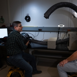
Vine Robots for Collapsed Structure Mapping
These robots can navigate difficult urban disaster terrain to help responders locate and access victims for rescue.
Tags

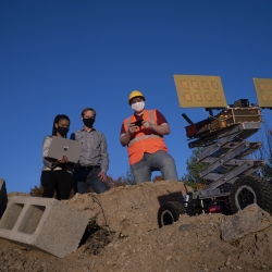
Low-Cost Localization Using Distributed Adaptable-Response Transponders
A deployable navigation network of small, low-cost radio transponders can help track the locations of first responders during rescue operations.
Tags
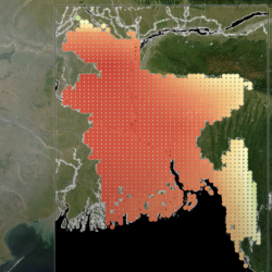
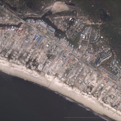
Climate Resilience Early Warning System Network
We are creating proactive, integrated decision -support tools and services that empower frontline communities to prepare for climate impacts and minimize losses.
Tags
Motion Under Rubble Measured Using Radar
Our see-through-wall sensor is a lightweight, portable technology that peers through rubble and debris of a disaster site to detect survivors.
Tags
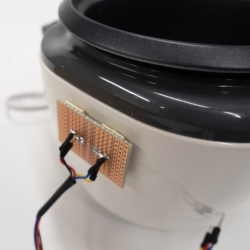
Smart Photovoltaic Microgrids for Cooking in Disadvantaged Communities
By connecting a PV microgrid powered by solar panels to homes, engineers could provide people who live in regions of power-insecurity with the energy to cook their meals. Unused power could be applied to phone-charging stations.
Tags
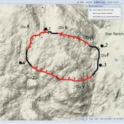
Next-Generation Incident Command System
Emergency agencies around the world are using NICS to coordinate rapid and organized response to disasters.
Tags