
Projects
Tagged As
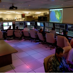
Reagan Test Range Automation and Decision Support
New software tools provide test operators with automated decision support for directing sensors during increasingly complex tests conducted at the Reagan Test Range (RTR).
Tags
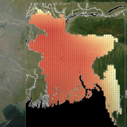
Climate Resilience Early Warning System Network
We are creating proactive, integrated decision -support tools and services that empower frontline communities to prepare for climate impacts and minimize losses.
Tags

Explainable Artificial Intelligence for Decision Support
We are developing tools to enhance the explainability of artificial intelligence (AI) systems for improved human-AI collaboration.
Tags
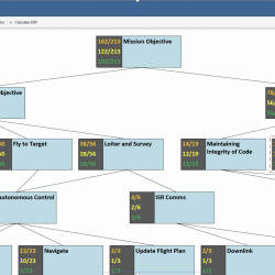
High Assurance Design Environment
A new tool enables mission system designers to design for functionality and security together and provide evidence for how design choices affect a mission’s security posture.
Tags
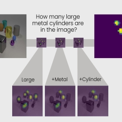
Transparency by Design Network
A new neural network model reveals some of the mystery behind the decision-making capability of artificial intelligence systems.
Tags

Video-Rate Standoff Microwave Imaging System
The system can rapidly and discreetly detect threat items concealed under clothes or hidden in bags of people in crowded public spaces.
Tags

Optical Processing Architecture at Lincoln
Our researchers developed a software architecture that allows analysts to rapidly run algorithms on the volumes of sensor data collected about space objects.
Tags

14th Air Force Detachment — Space Tactics Internship
A program created by the Air Force Space Command and Lincoln Laboratory gives participants experience with advanced systems and processes for managing space operations.
Tags

Forensic Video Exploitation and Analysis Tool
The tool lets security officials quickly analyze video surveillance footage and track incidents of interest.
Tags
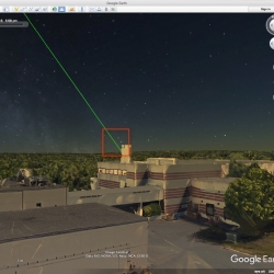
Laser Aircraft Strike Suppression Optical System
A system that detects laser beams being shone into the sky and alerts police of their source can help protect pilots and aircraft.
Tags