
Projects
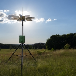
Portable Aircraft-Derived Weather Observation System
A low-cost technology can increase the number and quality of wind and temperature atmospheric observations made by aircraft to improve forecasts.
Tags
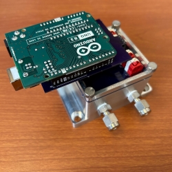
Low-Cost Methane Sensor Network
Deploying large networks of ground-based methane detectors could help detect pipeline leaks, improve climate models, and regulate emission sources.
Tags
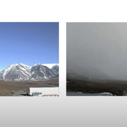
Visibility Estimation through Image Analytics
An algorithm uses camera imagery to estimate visibility for pilots flying in remote areas that lack weather sensors.
Tags
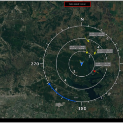
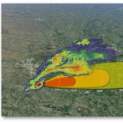
Ground-Based Sense-And-Avoid System
A radar and guidance system enables uncrewed aircraft systems (UAS) to avoid collisions with other aircraft in the National Airspace System.
Tags
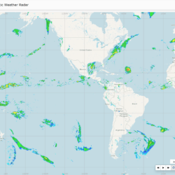
Global Synthetic Weather Radar
By compiling lightning data, satellite imagery, and numerical weather models, the GSWR provides radar-like analyses and forecasts over regions not observed by actual weather radars.
Tags
Intelligent Tornado Prediction Engine
We compiled a massive open-source dataset to develop deep learning models capable of detecting and predicting tornadoes.
Tags

Aerial Refueling Optimization Engine
Our model optimizes the scheduling of aerial refueling missions, saving fuel and costs for the Department of War.
Tags
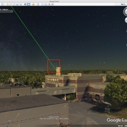
Laser Aircraft Strike Suppression Optical System
A system that detects laser beams being shone into the sky and alerts police of their source can help protect pilots and aircraft.
Tags

Small Airport Surveillance Sensor
An affordable radar surveillance system will help tower controllers at small airports monitor traffic even under poor visibility conditions.
Tags

Airborne Collision Avoidance System X
A next-generation collision avoidance system will help pilots and unmanned aircraft safely navigate the airspace.
Tags