
Projects
Tagged As
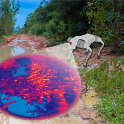
HYPE2GO: Cost Maps from Hyperspectral Imaging
The HYPE2GO project seeks to augment autonomous system terrain understanding with hyperspectral imaging.
Tags

Dual-Use Waveforms for Radar Detection and Wireless Communication
New waveforms enable efficient spectrum sharing between radars sensing moving objects and wireless communications systems transmitting data.
Tags
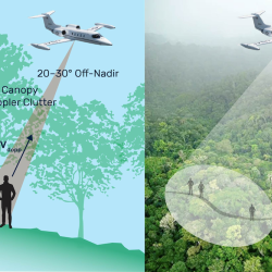
Finding People Under the Rainforest Roof with Lidar
Lincoln Laboratory is exploring the feasibility of building an airborne sensing system to detect the presence of humans under dense tree canopy.
Tags
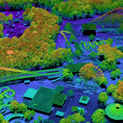
PHOENIX High CASTLE
We developed a ladar that samples at the diffraction limit to collect high-resolution imagery for geospatial mapping missions.
Tags
Methane Detection Study
We are investigating the use of novel imaging technologies for detecting and quantifying methane emissions in the atmosphere.
Tags
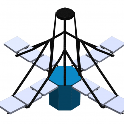
Deployable In-Space Coherent Imaging Telescope
Technologies enabling the deployment of an expandable telescope from a small spacecraft could pave the way for the development of other payloads for small satellites.
Tags
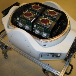
Multi-Aperture Sparse Imager Video System
An airborne system provides high-resolution wide-area video imagery and onboard data processing to enable real-time monitoring of suspicious human activity.
Tags

Video-Rate Standoff Microwave Imaging System
The system can rapidly and discreetly detect threat items concealed under clothes or hidden in bags of people in crowded public spaces.
Tags

Charge-Coupled Devices for REXIS on OSIRIS-REx
Our CCDs will image X-rays emitting from elements on the surface of the asteroid Bennu.
Tags