Atmospheric Aerosol Characterization
Predicting climate change and its associated risks is difficult because scientists lack quality observations of key variables. Two of these variables are the types of aerosols and the amount of each type trapped in the atmosphere. Laboratory researchers are studying a novel satellite-based lidar architecture that can improve aerosol typing. This information can help enable more accurate prediction of the effect of aerosols on the Earth's climate.
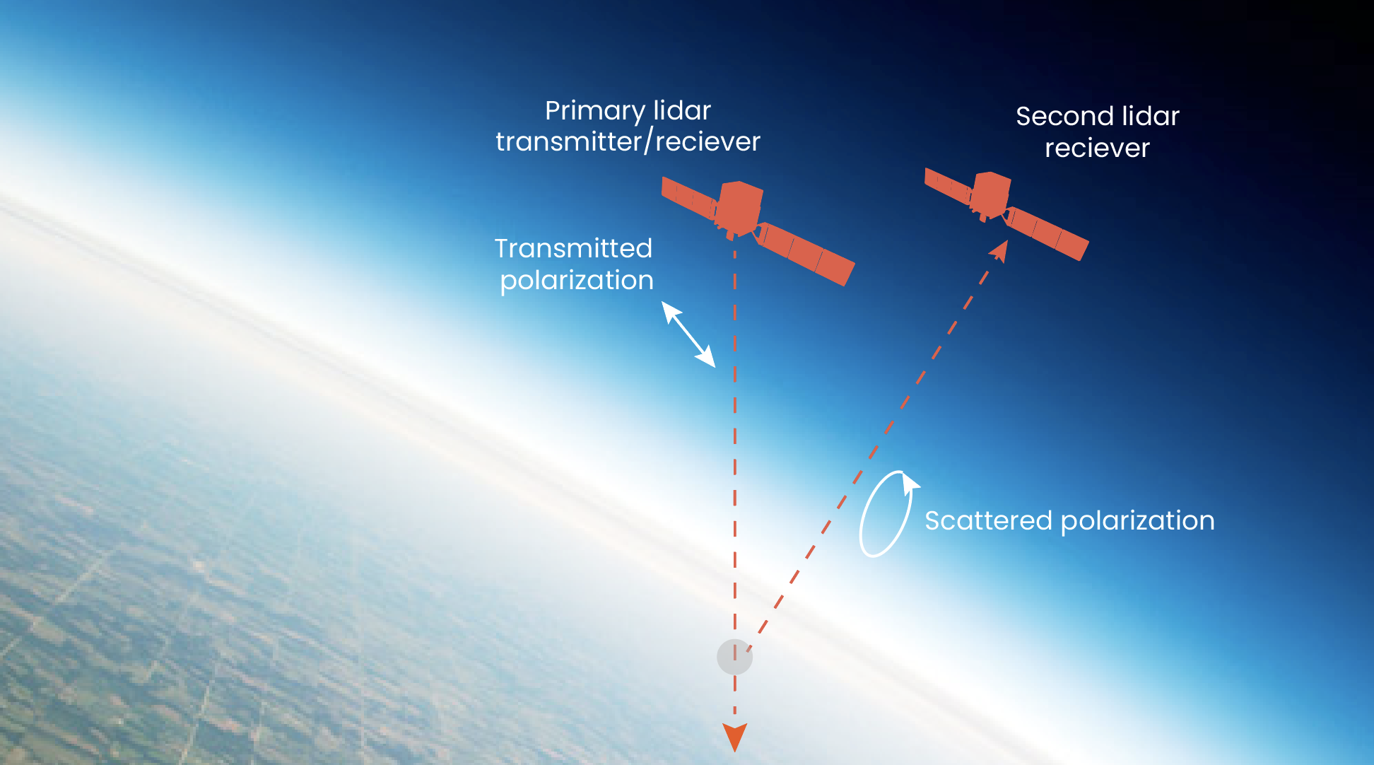
The proposed architecture augments a satellite-based lidar transmitter/receiver with a second lidar receiver satellite, which flies in formation with the transmitting satellite and measures obliquely scattered light. The primary satellite transmits polarized laser pulses, and the second satellite forms polarization-analyzed lidar images of the illuminated column in the atmosphere. Because of its oblique view, the second satellite sees changes in polarization that are inaccessible to the primary satellite. These changes in polarization provide information that helps to categorize the aerosols.
Related
News

Ultra-efficient AI won’t solve data centers’ climate problem. This might.

Q&A with Vijay Gadepally on the climate impact of generative AI