
Projects
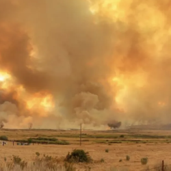
Wildfire Working Group
A group of non-profit organizations joined forces to assess the nation’s wildfire crisis and provided key recommendations.
Tags
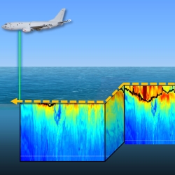
Measuring Subsurface Ocean Properties from the Air
A sensor capable of rapidly collecting high-resolution data on ocean temperature, salinity, and sound speed remotely could improve forecasting for defense missions.
Tags
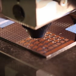
Low-Temperature Additive Manufacturing of Glass
An innovative approach to additive manufacturing of multimaterial glass items precludes the need for costly high-temperature processing techniques.
Tags

Superconducting Content-Addressable Memories (SuperCAMs)
Unconventional memory circuits can accelerate data processing in cyber sensing devices by reducing the latency of matching complex data patterns to specialized processing pipelines.
Tags
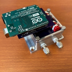
Precision Clock Synchronization for Advanced Sensing
Combined quantum networking and lasercom optical signaling techniques could impact advanced sensing applications such as geolocation with distributed systems.
Tags
Low-Cost Methane Sensor Network
Deploying large networks of ground-based methane detectors could help detect pipeline leaks, improve climate models, and regulate emission sources.
Tags
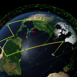
Networking for a New Era of Global Satellite Connectivity
Large constellations of satellites in low Earth orbit (LEO) allow for unparalleled global coverage but require new networking approaches.
Tags

Mitigating Cellular Network Congestion Through Adaptive Beamforming With Reflectarrays
A low-cost, reconfigurable radio receiver architecture provides an alternative approach to filter out unwanted transmissions in millimeter-wave (MMW) signals.
Tags
Vine Robots for Collapsed Structure Mapping
These robots can navigate difficult urban disaster terrain to help responders locate and access victims for rescue.
Tags
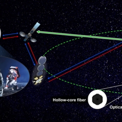
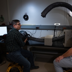
Guiding Light in Air-Filled Fibers for Long-Distance Lasercom
A new type of fiber could transmit the high-power light needed for future deep-space science and exploration missions.
Tags