
Projects
Tagged As
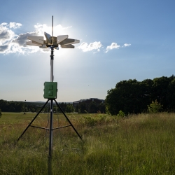
Portable Aircraft-Derived Weather Observation System
A low-cost technology can increase the number and quality of wind and temperature atmospheric observations made by aircraft to improve forecasts.
Tags
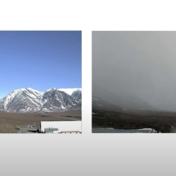
Visibility Estimation through Image Analytics
An algorithm uses camera imagery to estimate visibility for pilots flying in remote areas that lack weather sensors.
Tags
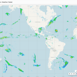
Global Synthetic Weather Radar
By compiling lightning data, satellite imagery, and numerical weather models, the GSWR provides radar-like analyses and forecasts over regions not observed by actual weather radars.
Tags