Visibility Estimation through Image Analytics
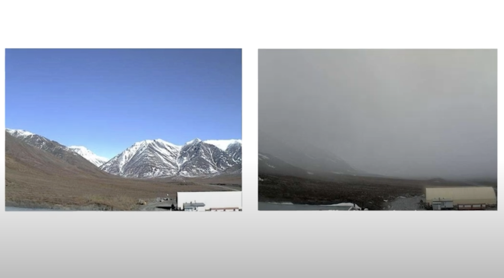
The Visibility Estimation through Image Analytics (VEIA) technology provides an inexpensive and robust way to extract meteorological visibility from cameras — thus transforming cameras into weather sensors. The VEIA algorithm uses the presence and strength of edges in an image to provide an estimation of the meteorological visibility within the scene. The algorithm compares the overall edge strengths of the current image to those from a clear-day representation, which is generated by creating a composite image from several days of imagery. These estimates of visibility can then be shared among forecasters and with pilots online in real time. This capability is especially needed in remote areas lacking weather sensors that also have extreme terrain, such as in Alaska and Hawaii.
Read more:
An algorithm with an eye for visibility helps pilots in Alaska
Related
News
SkyGrid and MIT Lincoln Laboratory partner to advance weather forecasting