Projects
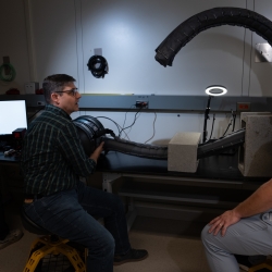
Vine Robots for Collapsed Structure Mapping
These robots can navigate difficult urban disaster terrain to help responders locate and access victims for rescue.
Tags
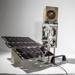
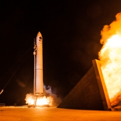
TROPICS
A constellation of small satellites is collecting rapidly refreshed weather data to advance studies of hurricane structure and intensity and improve forecasts.
Tags
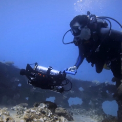
Undersea Vision-Based Navigation and Pose Determination for Human-Robot Teaming
Undersea vision-based navigation and pose determination will enable divers and robots to collaboratively solve complex tasks in an inherently unstructured environment.
Tags
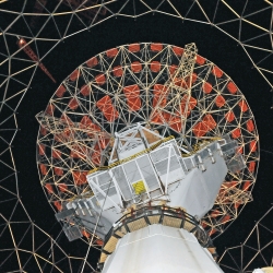
Haystack Ultrawideband Satellite Imaging Radar
Lincoln Laboratory created the world's highest-resolution radar for imaging of space objects in support of space situational awareness.
Tags

Transiting Exoplanet Survey Satellite
A new planet hunter will spend the next two years searching for exoplanets, including those that could support life.
Tags


Prototype Airborne Contested Environment Communication Relay (PACECR)
A system enables aircraft to replace a satellite communications network.
Tags
Groundhog
A ground-penetrating radar that detects objects deep underground can also help keep a self-driving automobile in its lane.
Tags