
Human Resilience Technology
We use our experience developing sensors, analytics, and decision support software to build technologies and systems that improve human resilience by aiding in wildfire response coordination, urban search-and-rescue missions, damage assessments after hurricanes and earthquakes, and large-scale evacuation planning. We work closely with local, state, and federal agencies to develop these technologies. Our goal is to enable organizations to more effectively gain situational awareness, share information, and make decisions in times of crisis. We also prototype technologies that facilitate civilian–military collaboration, which helps to improve the safety of civilians in conflict areas, and develop advanced airborne sensing capabilities to aid the nation in recovering from large-scale disasters. Many of our programs involve collaboration across Laboratory groups whose technologies can be applied to human resilience missions.
Featured Projects
systems analysis
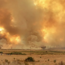
Wildfire Working Group
A group of non-profit organizations joined forces to assess the nation’s wildfire crisis and provided key recommendations.
humanitarian assistance
CrisisChat
An emergency response chatbot aims to enable centralized and reliable communications between the public and first responders.
autonomous systems
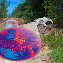
HYPE2GO: Cost Maps from Hyperspectral Imaging
The HYPE2GO project seeks to augment autonomous system terrain understanding with hyperspectral imaging.
disaster relief
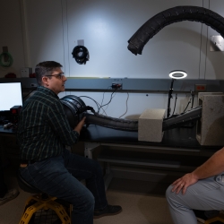
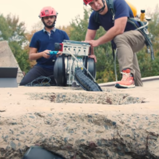
Vine Robots for Collapsed Structure Mapping
These robots can navigate difficult urban disaster terrain to help responders locate and access victims for rescue.
disaster relief
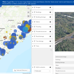
Multi-label Dataset and Classifiers for Low-Altitude Disaster Imagery
This software program helps disaster responders extract actionable information from post-disaster aerial images.
Latest News

Laboratory Stories
I find inspiration in the people around me.
Nathaniel Hanson
Robotics and Remote Sensing Engineer
Biotechnology and Human Systems
Human Resilience Technology

I am always looking for ways to make the lives of my teammates easier and make the survivor experience better.
Chad Council
Systems Analyst
Biotechnology and Human Systems
Human Resilience Technology

Advancing Our Research
Featured Publications
Satellite remote sensing in disaster relief: FY23 HADR Technical Investment Program(9.12 MB)
Jun 13
MIT Lincoln Laboratory Report MIT-LIN-TIP-197
Automated exposure notification for COVID-19
Feb 14
MIT Lincoln Laboratory Report TR-1288
Development and validation of the public-facing SimAEN web application
Aug 1
MIT Lincoln Laboratory Report ACTA-6