ML-HYDRAS: Machine Learning-Hydrodynamic Driven Rapid Assessment of Storms
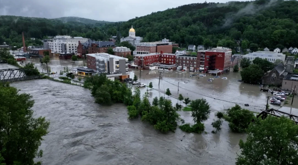
Flood events have become more common and deadly in the last decade as storms move more slowly and less predictably than historical norms. Flood hazards are often communicated through flood depth maps, yet flow velocity during floods can destabilize cars, damage infrastructure, endanger pedestrians, and cut off access to emergency routes. Flood hazards combine water depth, water velocity, and the transport of debris such as trees or sewage. Flood modeling that simulates all three components must be accurate, timely, and trustworthy to provide crucial support to decision-makers to prepare for, respond to, and recover from flood disasters.
Current operational flood models fall into two categories: (1) statistical or machine-learning simulations that produce flood depth maps in minutes, but do not simulate the flow velocity or debris transport, and (2) physics-based numerical models that simulate all flood hazards but take hours to days to run. With extreme weather occurring more frequently, there is an urgent need to bridge the gap between physical fidelity and operational speed.
To meet this need, MIT Lincoln Laboratory’s Human Resilience Technology Group is developing the Machine Learning-Hydrodynamic Driven Rapid Assessment of Storms (ML-HYDRAS), a near-real-time flood model developed by training a physics-informed machine learning model on synthetic datasets from industry-standard hydrodynamic simulations. The model preserves physical consistency (i.e., conserves mass) while achieving inference times in minutes.
ML-HYDRAS will allow stakeholders and users to analyze flood conditions for specific geographical regions of interest through quick and accurate ensemble simulations that quantify flood water depth, velocity, and subsequent infrastructure damage and debris transport. Operationally, this capability could directly inform evacuation routing, resource allocation, and recovery prioritization. It could also facilitate analysis of flood mitigation measures for critical infrastructure, airfields, data centers, and military installations.
The initial model development focuses on communities recently impacted by severe flooding such as Montpelier, Vermont and Asheville, North Carolina. The ML-HYDRAS team is currently looking for sponsors to fund continued model development and collaborators to validate the model on real-world storm data and in diversified geographic regions for further refinement.
Inquiries, contact Julia Hopkins.
Related
News

Enabling privacy-preserving AI training on everyday devices

New technologies tackle brain health assessment for the military

Ultra-efficient AI won’t solve data centers’ climate problem. This might.
Publications
Poisoning network flow classifiers [e-print]
Improving long-text authorship verification via model selection and data tuning
System analysis for responsible design of modern AI/ML systems
Quantifying bias in face verification system
Staff

Julia Ann Hopkins