
Projects
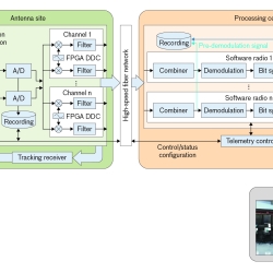
Telemetry Modernization with Open-Architecture Software-Defined Radio Technology
We conducted a software-defined radio technology development program to improve the way telemetered information is collected and processed.
Tags

High-Assurance Cryptography
Lincoln Laboratory is developing technologies to meet the highest standards for information security at the tactical edge.
Tags
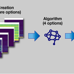
Combining Neural Networks and Histogram Layers for Underwater Target Classification
New machine learning methods capture statistical features within sonar data to distinguish between sound sources.
Tags
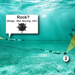
Underwater PB&J: Combining Diver and Robot Strengths for Optimized Mid-Mission Teaming
New navigation and vehicle autonomy algorithms consider which tasks humans and autonomous systems respectively do best, with the goal of improving search path planning and object classification in underwater environments.
Tags

Visibility Estimation through Image Analytics
An algorithm uses camera imagery to estimate visibility for pilots flying in remote areas that lack weather sensors.
Tags
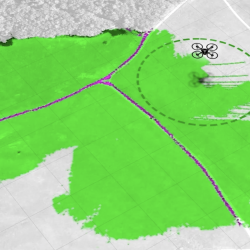
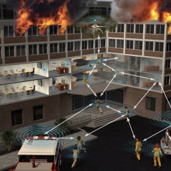
Autonomous Mobility Through Intelligent Collaboration
Teaming autonomous ground and aerial vehicles improves autonomous off-road military missions.
Tags
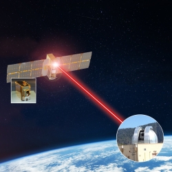
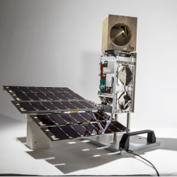
TeraByte InfraRed Delivery (TBIRD)
The laser communications payload has delivered terabytes of data from a satellite to Earth at record-breaking rates that will transform future science missions.
Tags
TROPICS
A constellation of small satellites is collecting rapidly refreshed weather data to advance studies of hurricane structure and intensity and improve forecasts.
Tags
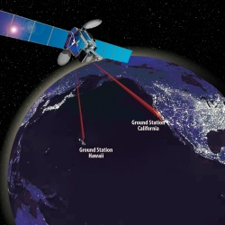
Laser Communications Relay Demonstration
Optical communications technologies decades in the making at Lincoln Laboratory were transferred to NASA for its first two-way laser relay communications system.
Tags
Radio-Based Navigation for Environments Without GPS
With the goal of enabling navigation in environments where GPS is unavailable or unreliable, researchers are developing algorithms to fuse information across a network of small, low-power radio-frequency devices.
Tags